If you're researching a Canadian soldier — a grandfather, a great-uncle, a name on a family headstone — you know the problem. A service record tells you where he enlisted and where he was discharged. A regimental history tells you what the unit did. Neither tells you where he was on a given afternoon, or what he saw, or who was standing next to him when it mattered.
This is a case study in closing that gap. Earl Olmsted was a Canadian artillery officer who came ashore on D-Day and fought through to Germany. Eighty years later, his grandson walked the same ground, holding the same log book Earl carried in his pocket. What follows is the war Earl had — reconstructed from four sources that, taken together, put him in specific places on specific days.
Project '44 is built to do this at scale, for any Canadian unit. This page is what the method looks like when it's applied to one man.
Juno Beach
6 June 1944Sources for this chapter: 13th Field Regiment RCA war diary, 6 June 1944 · Earl Olmsted's personal log book, entry for 6 June · Family photograph archive · Contemporary photography, Juno sector, 2024.
The landing sector and initial advance inland.
When live, this map will show all 23 waypoints of Earl's route across five countries, each linked to the war diary entry, the log book page, and the family photographs from that location. The same view exists for every unit in the Project '44 archive.
On the morning of 6 June 1944, Earl Olmsted came ashore at Juno Beach with [unit]. The war diary records the landing at [time]; Earl's own log book, found in a family box seventy years later, described the same morning in a single underlined line.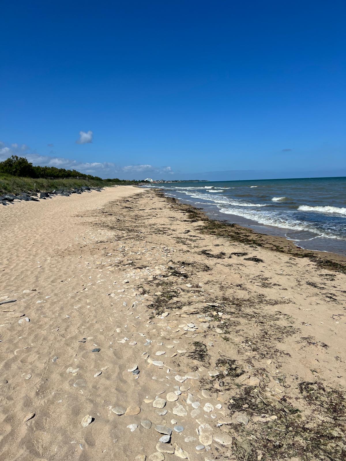
Behind enemy lines
Mid-June 1944Sources for this chapter: War diary, mid-June 1944 · Log book entries, Normandy advance · Contemporary photography, route to General Foster's position, 2024.
The route forward — past the front line to General Foster's position.
When live, this map will show all 23 waypoints of Earl's route across five countries, each linked to the war diary entry, the log book page, and the family photographs from that location. The same view exists for every unit in the Project '44 archive.
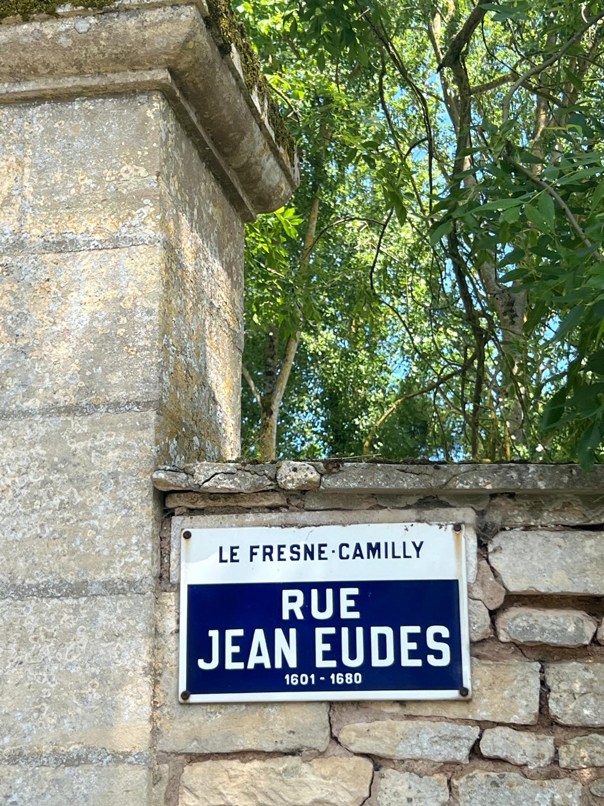
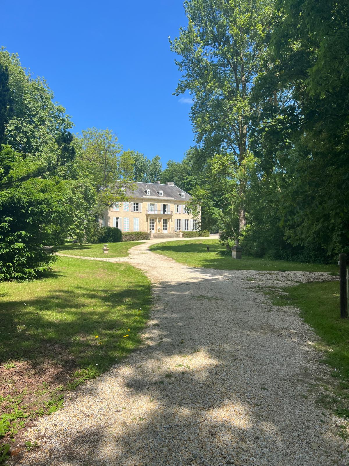
The chateau
Summer 1944Sources for this chapter: War diary · Log book · Olmsted family photographs, Normandy · Contemporary photography, 2024.
The chateau — south of the beachhead, summer 1944.
When live, this map will show all 23 waypoints of Earl's route across five countries, each linked to the war diary entry, the log book page, and the family photographs from that location. The same view exists for every unit in the Project '44 archive.
The bombing
9 August 1944Sources for this chapter: War diary · Log book · Olmsted family archive.
Position at first light, 9 August 1944.
When live, this map will show all 23 waypoints of Earl's route across five countries, each linked to the war diary entry, the log book page, and the family photographs from that location. The same view exists for every unit in the Project '44 archive.
On 9 August, Earl's position was bombed. The diary entry is brief; the log book is longer. He survived. Two men did not.
Zwolle
13–14 April 1945Sources for this chapter: War diary, April 1945 · Log book · Olmsted family photograph, Zwolle, April 1945 · Contemporary photography, Zwolle, 2024.
The advance through the Netherlands — from the Rhineland to Zwolle.
When live, this map will show all 23 waypoints of Earl's route across five countries, each linked to the war diary entry, the log book page, and the family photographs from that location. The same view exists for every unit in the Project '44 archive.
By April 1945, Earl was a forward observation officer. His battery was parked in a field outside Zwolle, guns laid, ready to reduce the city — when a French-Canadian soldier named Léo Major walked in alone and liberated it instead.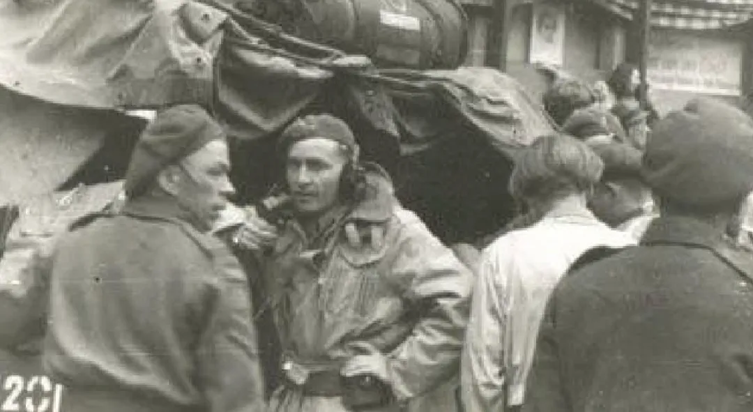
Scroll to follow Earl from the field outside the city to the radio photograph.
A road in Germany
Spring 1945Sources for this chapter: War diary, spring 1945 (naming the two soldiers killed) · Log book, final entries · Contemporary photography, field outside Zwolle, 2024.
The final positions — northern Netherlands into Germany.
When live, this map will show all 23 waypoints of Earl's route across five countries, each linked to the war diary entry, the log book page, and the family photographs from that location. The same view exists for every unit in the Project '44 archive.
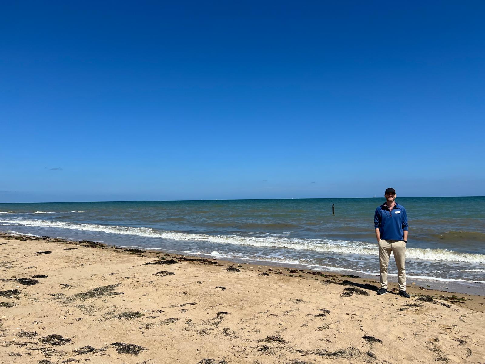
Weeks from the war's end, Earl's vehicle was struck by artillery. Two of his soldiers were killed. He was not. The diary entry names them. The log book ends shortly after. Earl Olmsted came home. He raised a family. Eighty years later, his grandson walked into the field outside Zwolle, stood where the guns had stood, and took a photograph of the horizon. That photograph is why this page exists.Researching your own soldier?
Earl's story is one reconstruction. The same method — war diaries, personal papers, family photographs, and ground-truthed geography — is how Project '44 is rebuilding the Canadian Army's war, unit by unit, day by day.
The full interactive archive is being built right now. The story map that ties Earl's 23 waypoints to their underlying diary entries and photographs is next to ship, and every unit in the Canadian Army will eventually have one. In the meantime, here's where to start:
- Read another story. Every case study on Project '44 is built from the same source layers you've just seen. → Browse the Stories index
- Follow the build. Patreon is where new units, new stories, and new map releases go out first. → Project '44 on Patreon