Project '44
The War, Mapped.
150,000 unit positions. Thousands of primary sources. One living archive.
Available Now
Start Exploring
These sections are live and ready to browse.
Photo Archive
250+ geotagged wartime photographs placed exactly where they were taken.
Browse photos →Earl Olmsted
One Canadian veteran's war — traced from enlistment to the liberation of Zwolle, mapped from war diaries and family photographs.
Read the story →Intel Blog
News, research updates, and behind-the-scenes dispatches from the Project '44 team.
Read the blog →The Map is Live
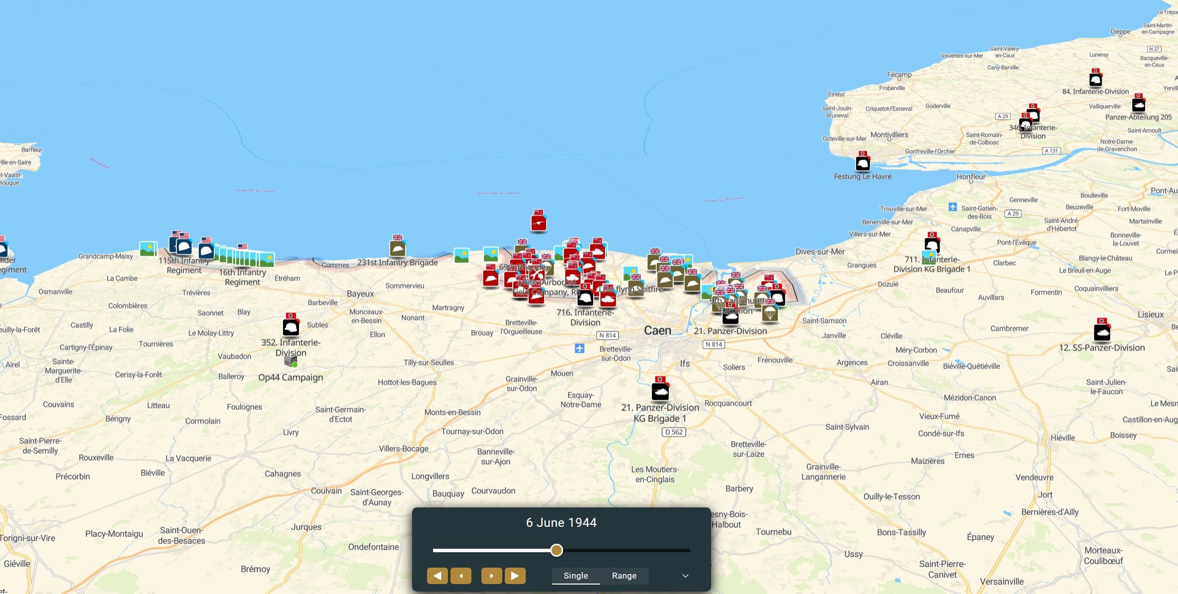
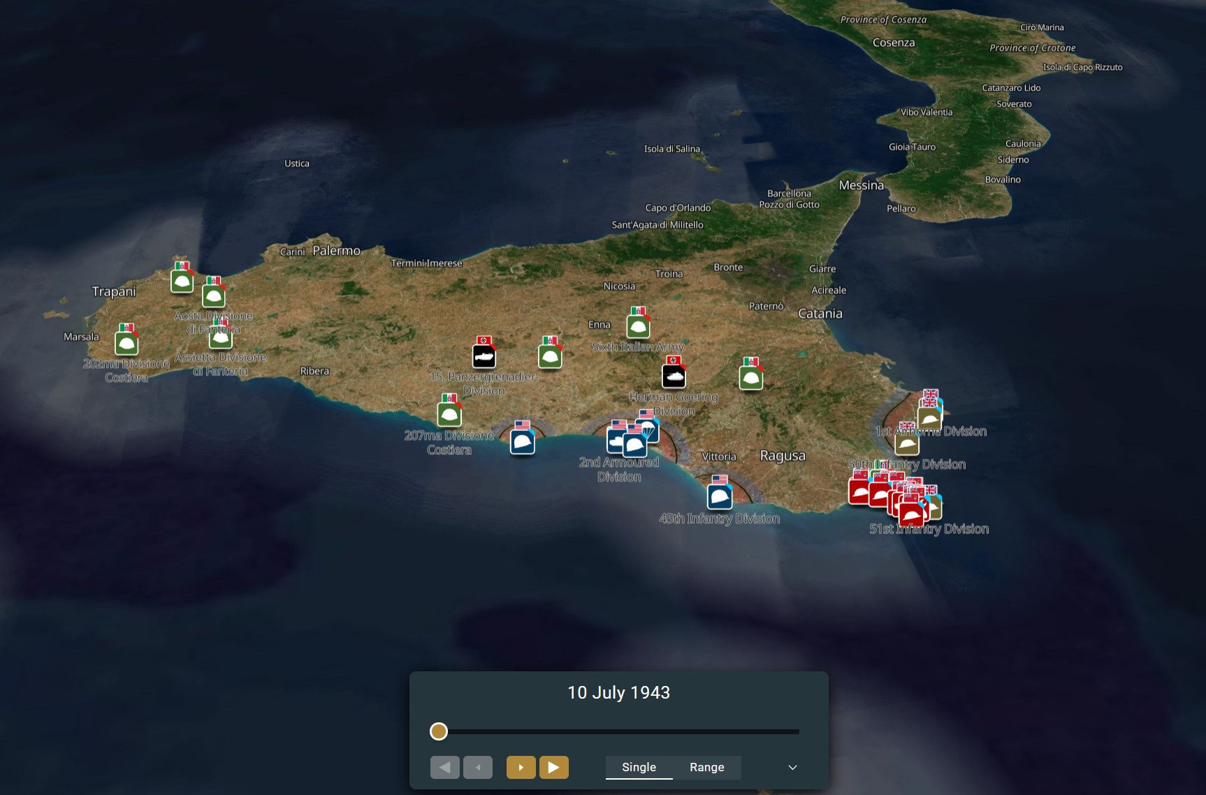
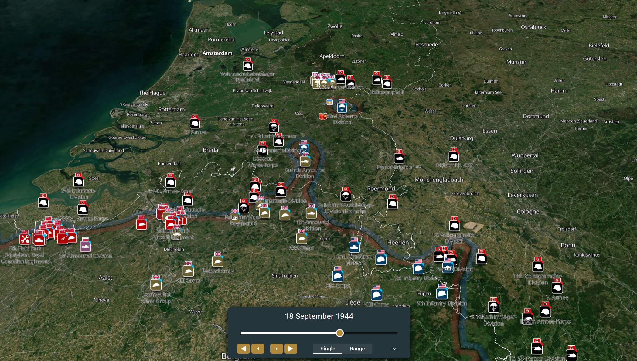
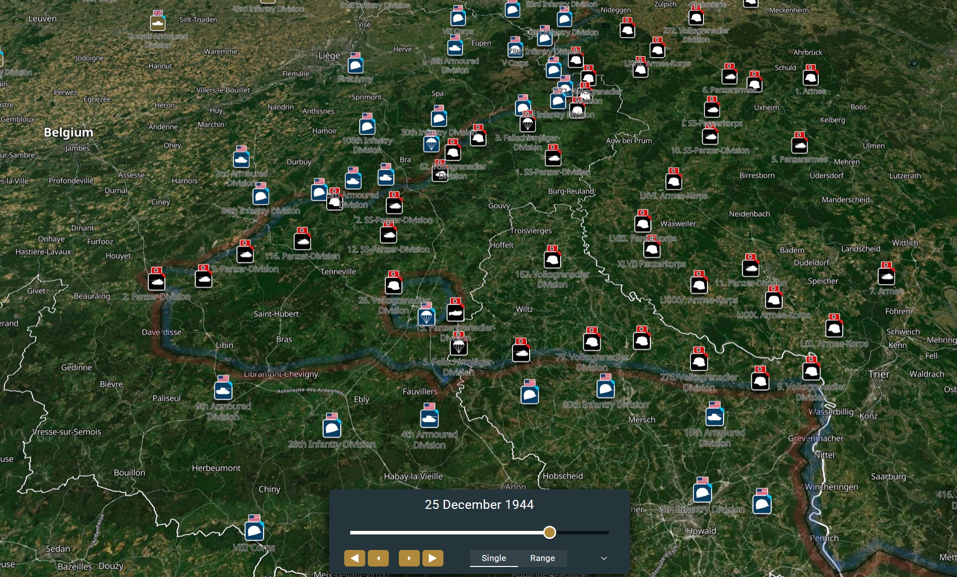
Zoom from theatre to foxhole. Every formation. Every phase line. Every day of the war.
Open the MapFrom the Archive
Geotagged photographs placed exactly where they were taken.
Browse the archive →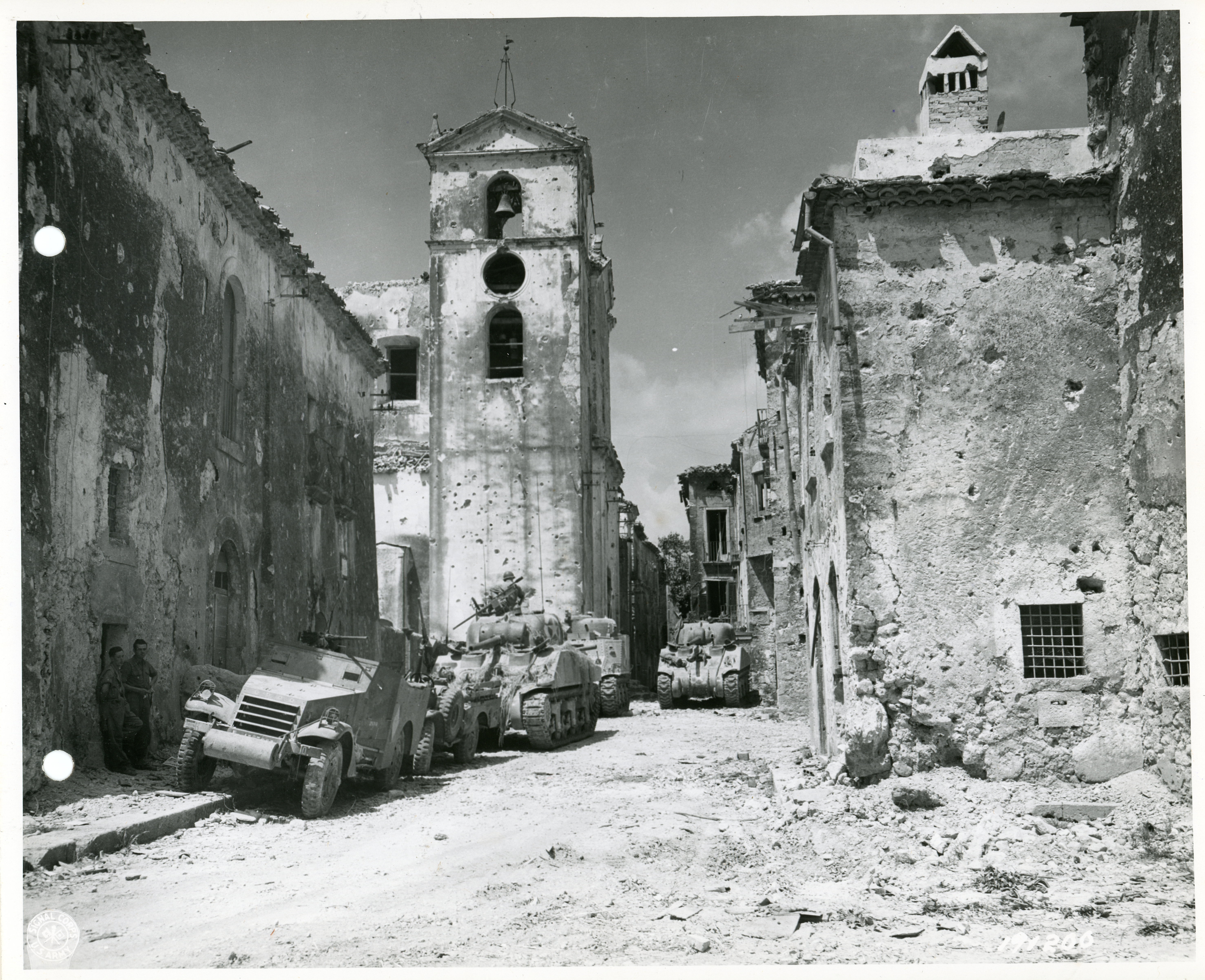 American and French armour onto Esperia!
Italy
American and French armour onto Esperia!
Italy
 A M-7 Priest rockes through Chiusdino
Italy
A M-7 Priest rockes through Chiusdino
Italy
 M-7 Priest advances Roccastrada
Italy
M-7 Priest advances Roccastrada
Italy
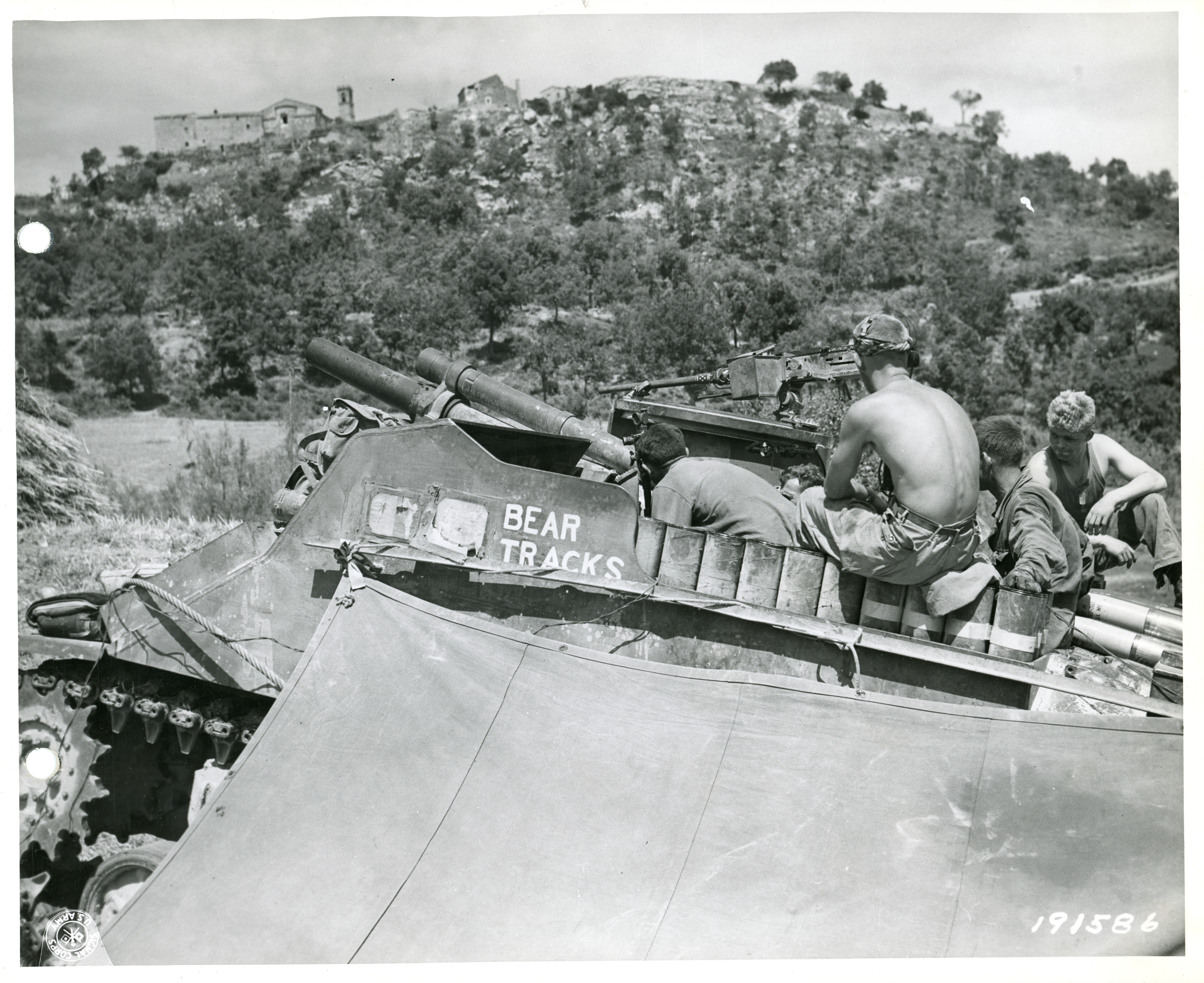 'Bear Tracks' M-7 Priest "sights-in"
Italy
'Bear Tracks' M-7 Priest "sights-in"
Italy
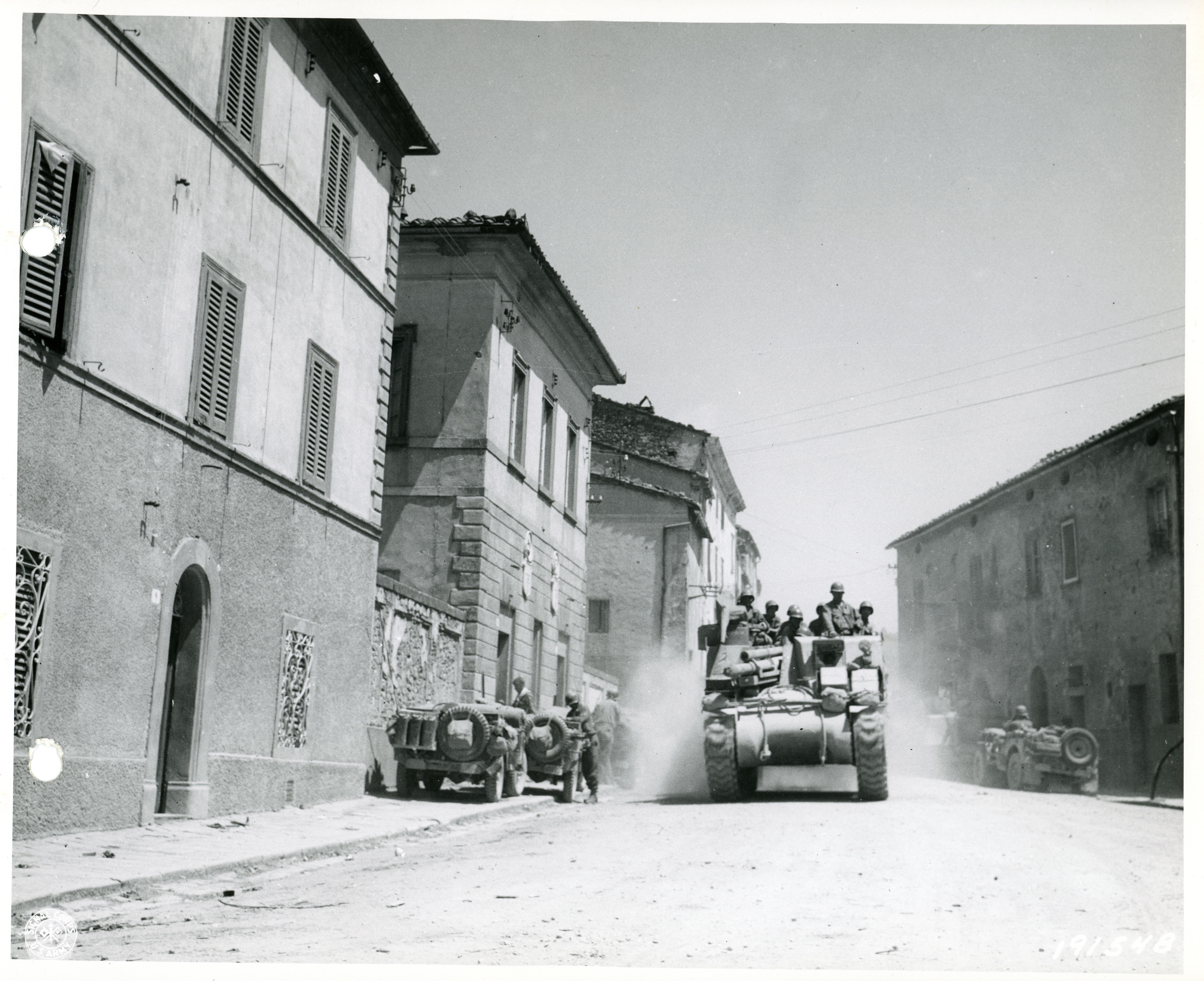
 M3 Stuart passing through Montaione
Italy
M3 Stuart passing through Montaione
Italy
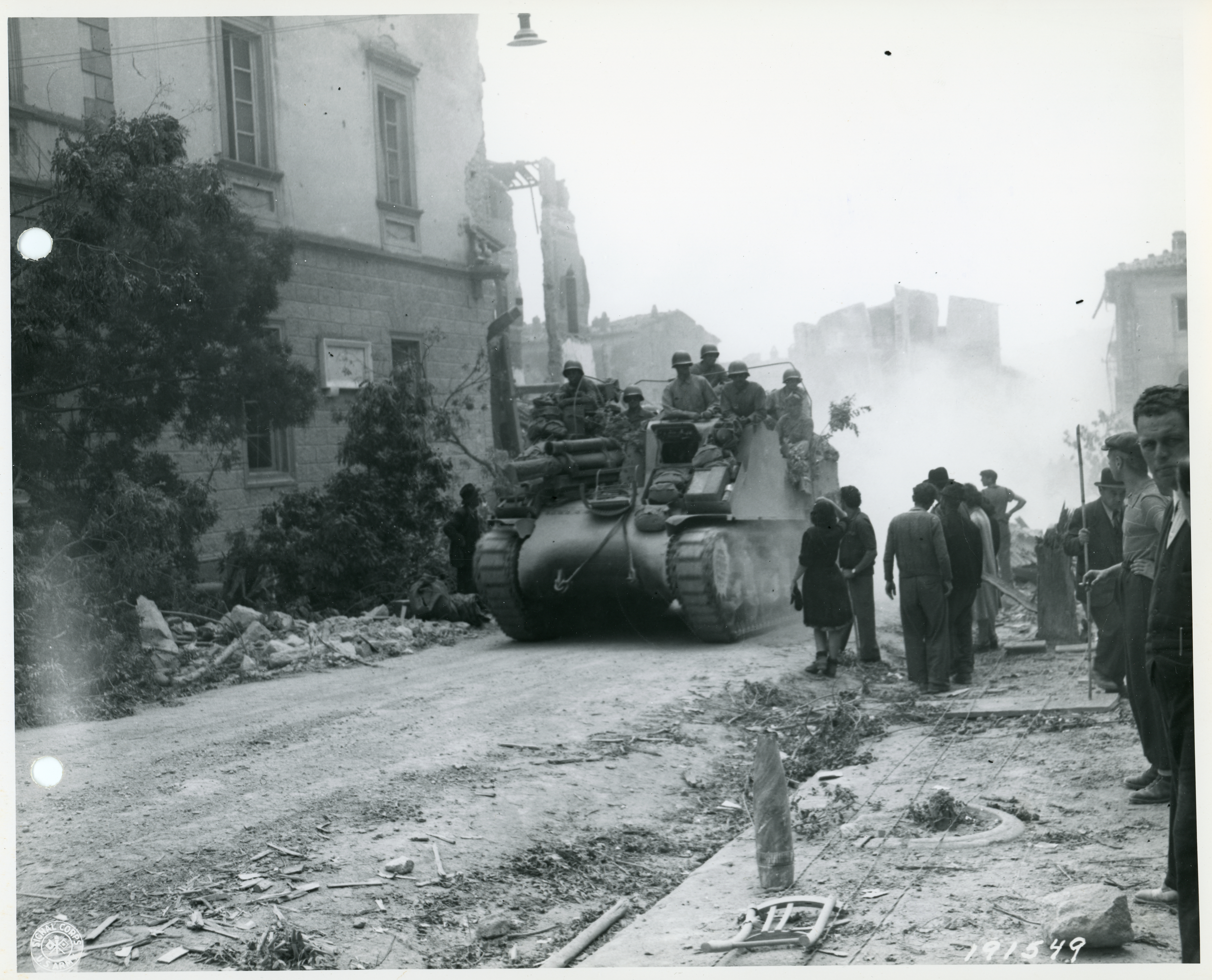
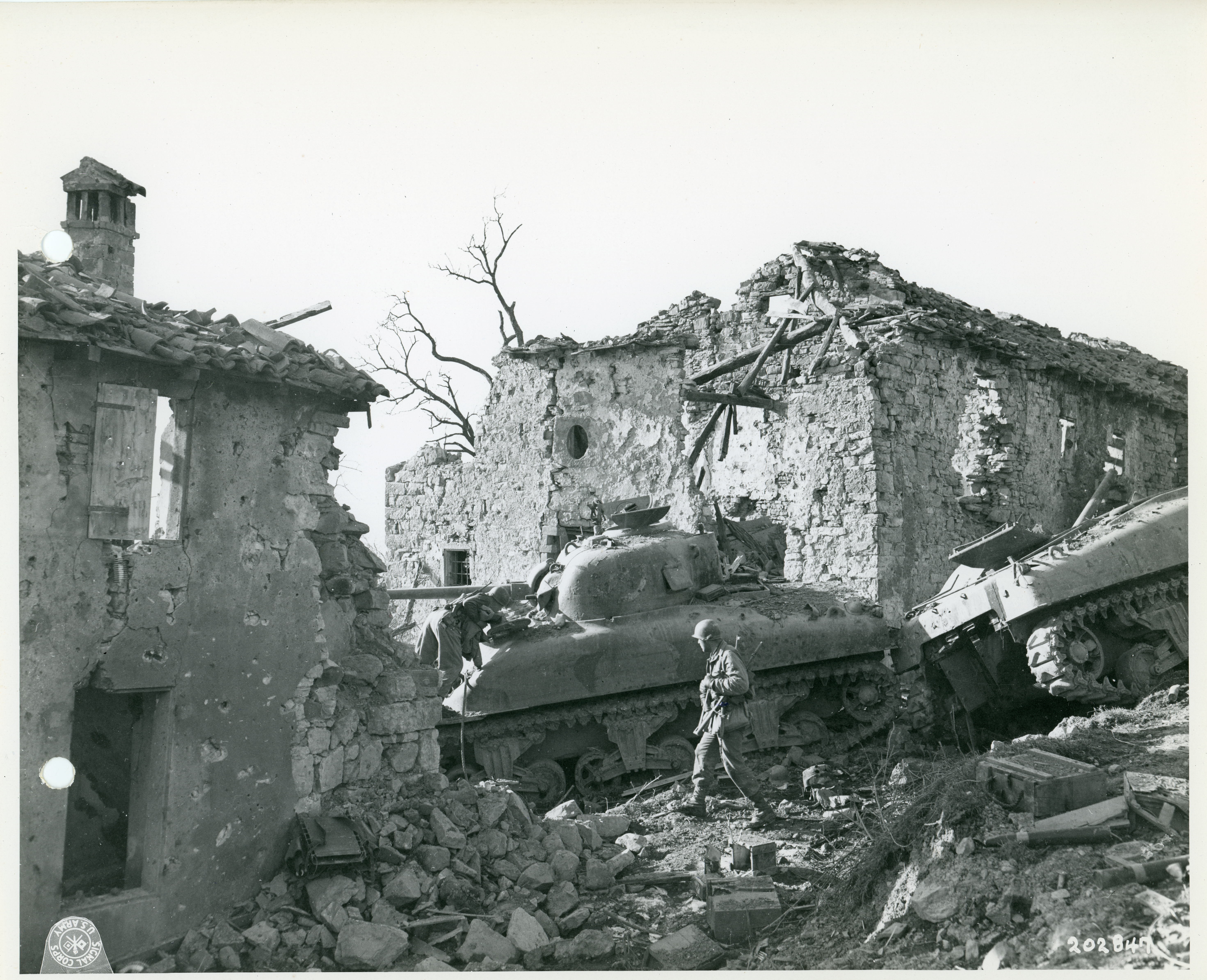 10th Mountain and 1st Armoured take Corona
Italy
10th Mountain and 1st Armoured take Corona
Italy
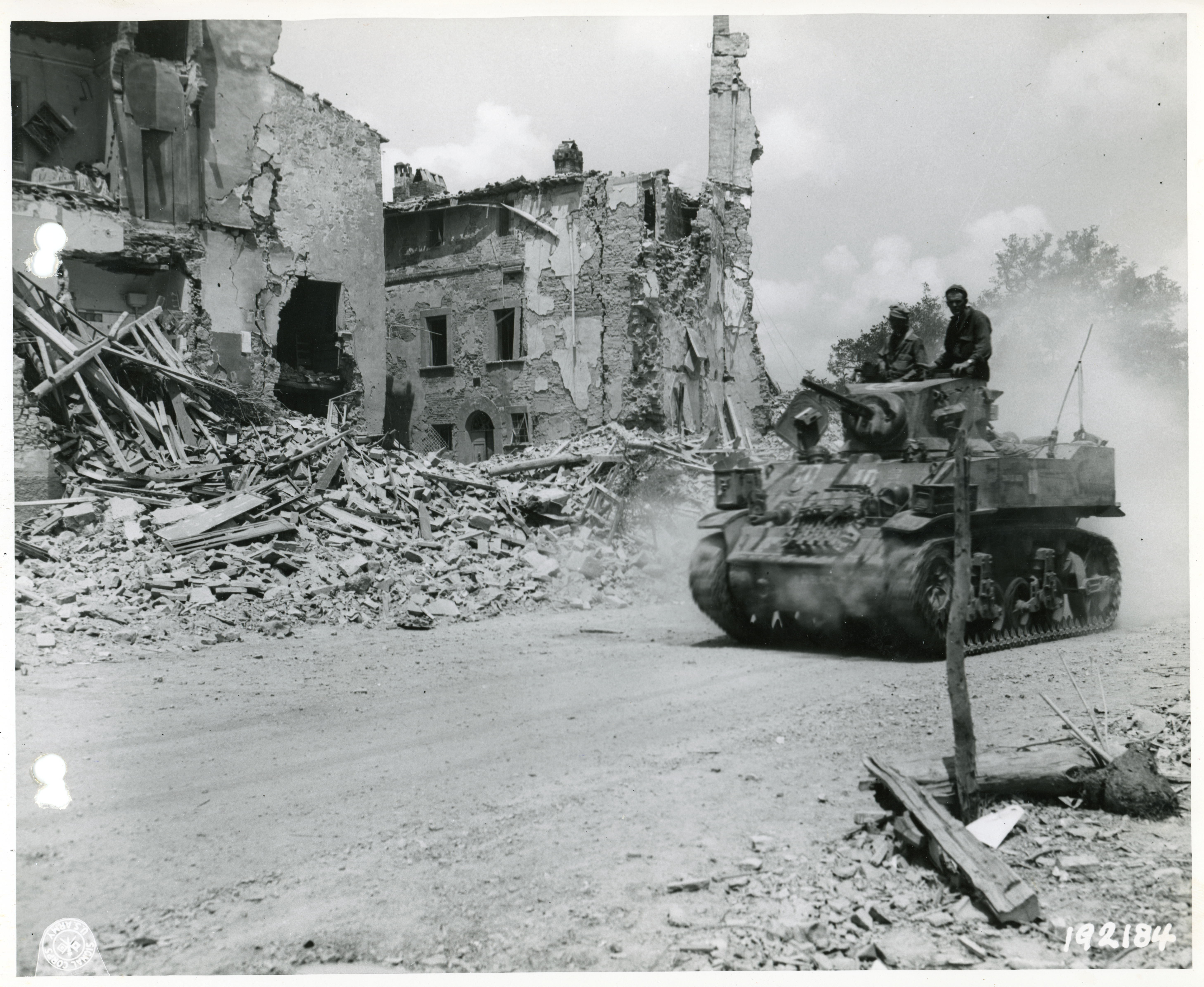
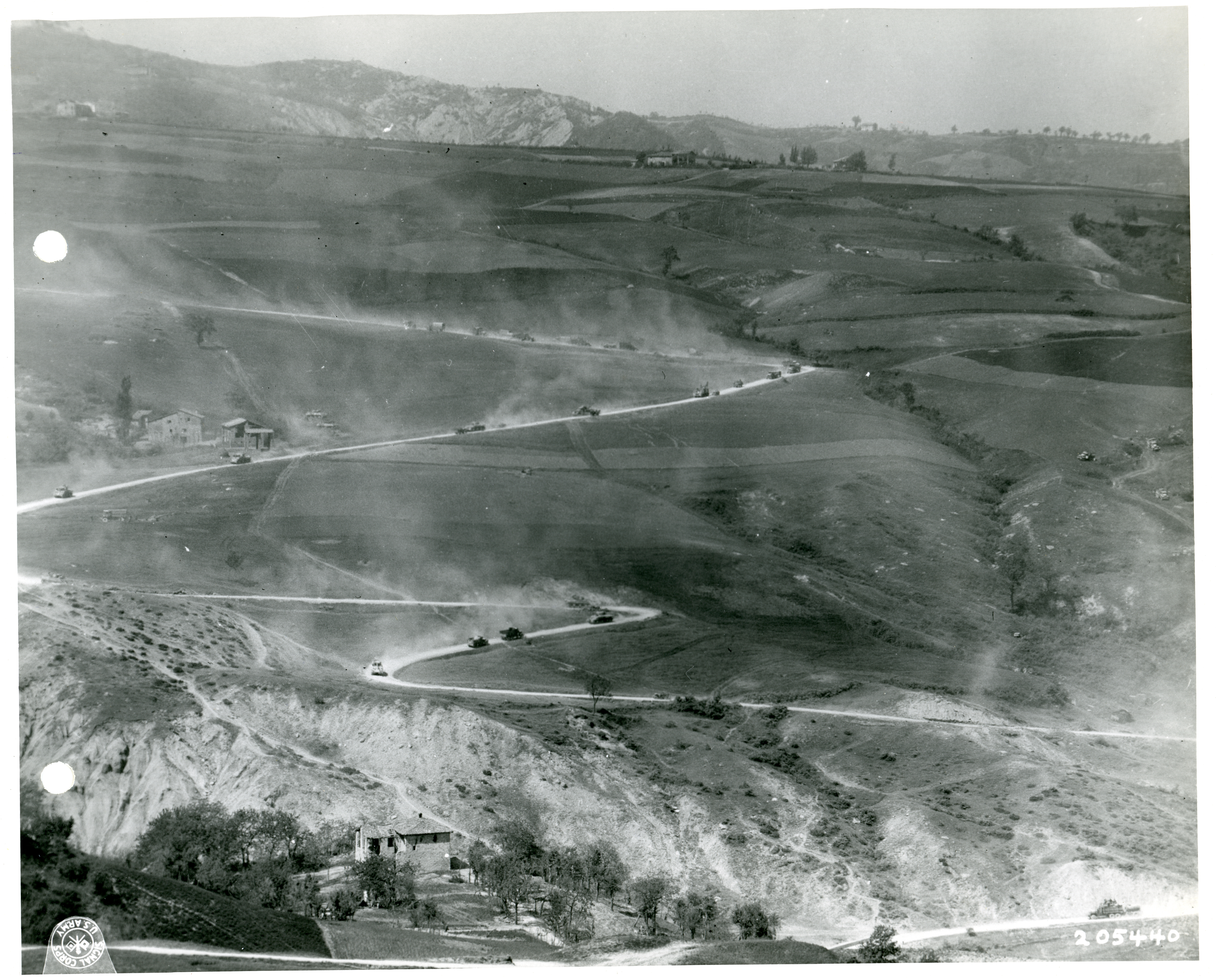 1st Armoured Division navigate a winding mountain road
Italy
1st Armoured Division navigate a winding mountain road
Italy
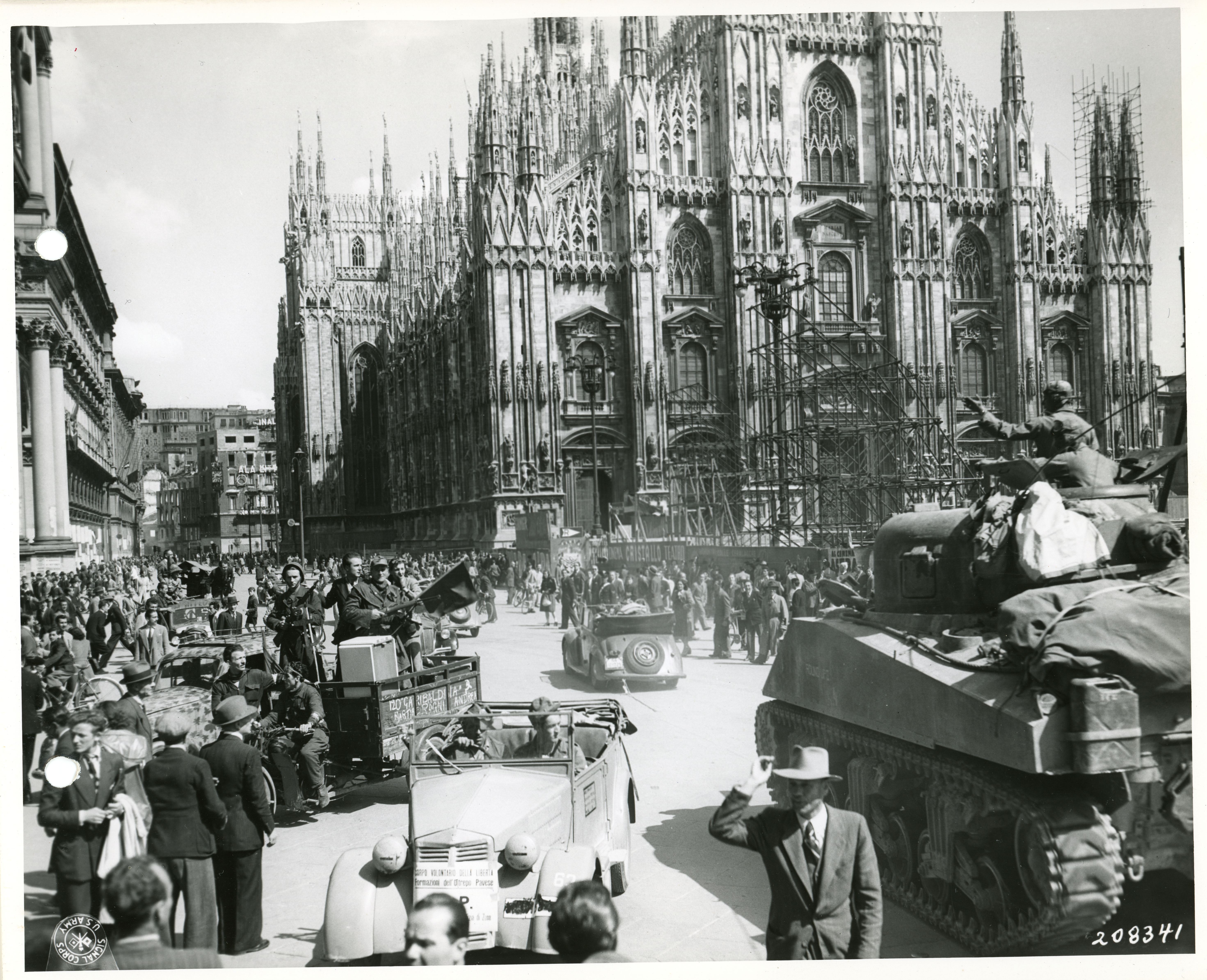 1st Armoured Division at the Piazza Duomo
Italy
1st Armoured Division at the Piazza Duomo
Italy
In Development
Coming Soon
We're building these sections right now. Support us on Patreon to help bring them to life.
Operations
Major operations of the Second World War — Overlord, Veritable, Market Garden, and more — mapped day by day.
Coming SoonTheatres of War
From Northwest Europe to the Pacific — explore every theatre of the Second World War on an interactive map.
Coming SoonUnits & Formations
Browse every infantry division, armoured brigade, and artillery regiment — tracked to the day.
Coming SoonCampaigns
Multi-operation campaigns from Normandy to the Rhineland, mapped with unit positions and primary sources.
Coming SoonWar Diaries
Digitized, indexed unit war diaries — the daily operational record kept by every formation in the field.
Coming Soon